A development prize for the idea we see the most potential in (using any open data set) - be creative! Prize: 1 year 'Masuri' membership (full-time hot desk) at Little Tokyo Two
Submitted by declanvong on Sat, 07/04/2015 - 16:23
Team Name:
Red Spatial
The Liveability Index is a website focused on informing users about the liveability state of every region in Australia, looking at aspects based on economy, demography and education. It allows the general public to see at a glance the status of areas down to the suburb level right across the country. It’s always interesting to find data about areas near you!
Submitted by ajmccluskey on Sat, 07/04/2015 - 16:07
Team Name:
NVM
Project Description
Parking is something that has infuriated us all at one time or another. There just never seem to be any free spots when you want them. But what if you knew the likelihood of finding a parking spot anywhere in the CBD for the exact time you wanted to park? What if you were given turn-by-turn directions for a route that maximised your chances of finding a park? We think there'd be less traffic, less frustration, and the world would be a better place.
Many government open-data provides geo-located info useful for disaster relief: real time fire hazard, tide and others. We see that these data can be integrated with mobile phones and other personal devices which has been proven to save lifes.
Project Naya integrate these two source of information to make disater relief efforts.
Submitted by cmcnamara87 on Sat, 07/04/2015 - 15:26
Team Name:
Dolphin Raiders
why did you choose to build it, what does it do, who is it for, et cetera. Also talk about the data you've reused, and how you've reused it. How does the project satisfy the prize categories you have selected?
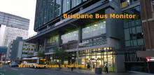
One of the most common question asked by passengers who use public transport system is what is the performance of the buses? Brisbane bus monitor is built to anwser the question, it is a responsive designed web site on top of Google Map java script library, Windows Azure Cloud service and a number of Java Script library like Jquery, bootstrap.
Anemu is a mobile app for helping people of all ages identify Australian wildlife in an easy and visual way. Users can use a photo of an animal they've taken with their phone and compare it to photos of other Animals, browsing based on how similar they think it looks. Once they've identified the animal, they can look up scientific information about the animal, see the last reported location it was seen and even view a list of articles related to that animal.
Submitted by JoshuaRiddell on Sat, 07/04/2015 - 10:53
Team Name:
UQ Hax0rs
SafeRoad is designed as a platform for finding high risk road areas. It can be used in planning mainentance and further development of road infrastructure such as signage, traffic flow management and road resurfacing. It can also assist in planning new emergnecy service home-base locations. For the public, the service highlights roads of high risk and could act to reduce road use in high-use and high-risk areas.